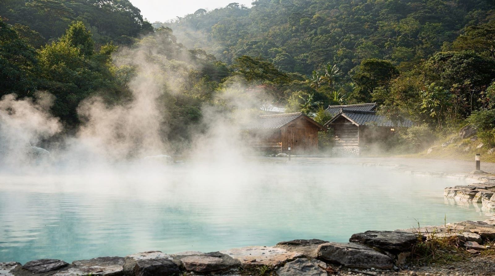
Taipei best hikes — ranked by effort, views, and access from the MRT
Taipei: Yangmingshan National park hiking day tour
What are the best hikes near Taipei?
Elephant Mountain (20 min, Taipei 101 views, MRT access), Yangmingshan's Seven Star Mountain (3 hr, volcanic summit, bus from MRT), Qingtiangang grassland loop (1.5 hr, easy, Yangmingshan), Wulai Neidong trail (2 hr, waterfall, forest), and Maokong tea hills (1–2 hr, gondola access). All reachable without a car from central Taipei.
Why Taipei is unexpectedly good for hiking
Most visitors come to Taipei for the food, temples, and night markets. A significant number are then surprised to discover that within 30–60 minutes of the MRT, they can be hiking volcanic ridgelines, walking past active fumarole fields, following riverside trails through dense subtropical forest, or looking down on Taipei 101 from a rocky summit.
Taipei sits in a volcanic basin surrounded on three sides by mountain ranges. Yangmingshan National Park to the north is a dormant shield volcano. The northeast coast has dramatic coastal trails. The river valleys running south and east of the city reach into forested mountain areas accessible by train and bus.
This guide ranks the best options by what type of hiker and time budget you have.
One thing worth knowing before you choose: hiking in Taipei is rarely a separate expedition. Most of these routes slot neatly into a day that also includes a hot spring, a teahouse, a market meal or a temple visit. The Yangmingshan hiking guide goes deeper on the park, and the Beitou hot springs guide shows how to finish a mountain day with a soak. If you are still sketching the wider trip, the Taipei first-timer guide puts the hikes in context with everything else the city offers.
| Where | Yangmingshan, Elephant Mountain, Wulai, Maokong, Pingxi Line |
| Cost | Free entry to all trails; transport around NT$30–160 depending on route |
| Time needed | 30 minutes (Elephant Mountain) to 3 hours (Seven Star Mountain) |
| Getting there | MRT plus bus or gondola — no car required for any route below |
| Best time | Early morning or October–November for the clearest views |
1. Seven Star Mountain, Yangmingshan — the flagship hike
Access: MRT to Jiantan, Bus S15 to Xiaoyoukeng (50 min total from Taipei Main) Distance: 4.5km round trip from Xiaoyoukeng Visitor Center Elevation gain: ~600m Time: 2.5–3 hours return Difficulty: Moderate (steep stone steps) Best for: Those wanting a genuine summit experience with panoramic views
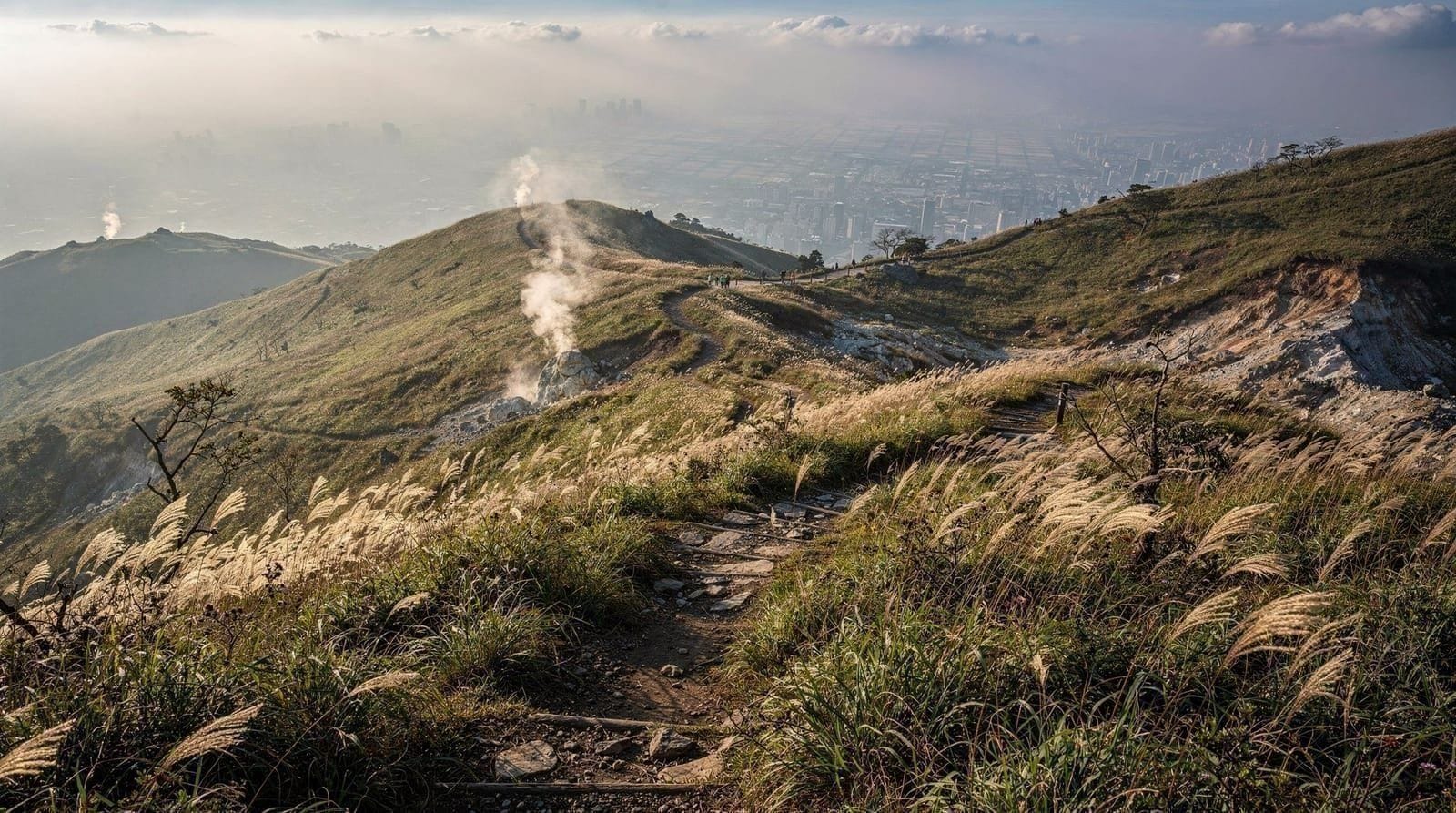
Seven Star Mountain (Qixing Shan, 1,120m) is the highest point reachable by public transport from Taipei without a car. The ascent from Xiaoyoukeng passes through cloud forest, across volcanic grassland, and up steep stone steps to a ridge walk and summit. On clear days — particularly in October and November — the views take in the Pacific, the Taipei Basin, and on exceptional days, Taiwan’s central mountain range.
The trail is well-maintained, clearly signed in English, and popular enough that you will rarely be entirely alone. But it is a real hike: the stone steps are steep, the upper section is exposed to wind, and the summit can be cold even when Taipei is warm below.
Combined option: Ascend Seven Star via Xiaoyoukeng, descend the alternative route to Lengshuikeng recreation area, and take the bus from there back to Taipei (different route, adds variety).
Yangmingshan National Park hiking day tour2. Elephant Mountain (Xiangshan) — the city skyline hike
Access: MRT Red Line to Xiangshan (end of line), 8-min walk to trailhead Distance: 1.4km round trip to main viewpoint Elevation gain: ~180m Time: 30–45 minutes return to main platform Difficulty: Easy-moderate (steep stone steps, short) Best for: Quick urban hike, Taipei 101 photography, dusk visits
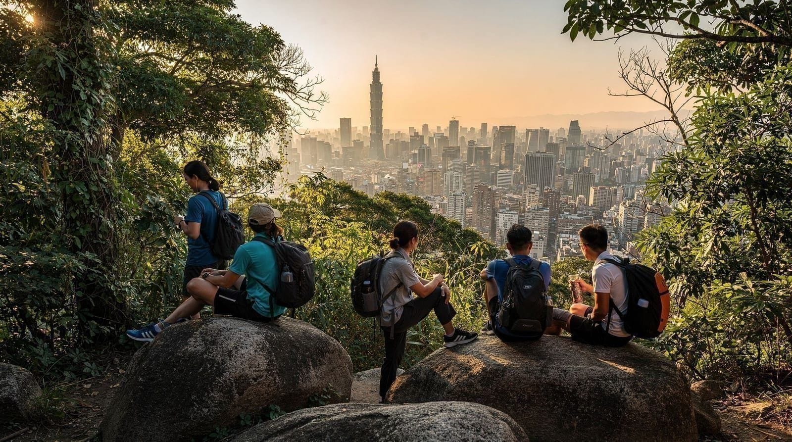
Elephant Mountain is the most accessible hike from Taipei’s city centre — the entire trailhead-to-viewpoint ascent takes 15–25 minutes. The reward is a close-range view of Taipei 101 across the Xinyi district, with the city spreading in both directions. Photographers congregate at the main rock platform at dusk for the skyline shot.
The trail continues beyond the main viewpoint along the Nangang mountain ridge (Sihou Shan trail) — a moderately demanding 8km extension to Nangang MRT for those wanting a longer outing.
See the detailed Elephant Mountain hike guide for the full breakdown.
3. Xiaoyoukeng fumarole boardwalk, Yangmingshan — accessible volcanic landscape
Access: Bus S15 from Jiantan MRT to Xiaoyoukeng Distance: 1.2km loop Time: 30–40 minutes Difficulty: Easy (paved boardwalk) Best for: Families, those with limited mobility, volcanic geology interest
The Xiaoyoukeng caldera is an active fumarole field — vents in the hillside emit constant steam and volcanic gases. The boardwalk circles the crater area with English interpretation on the geology. The visual is striking in any weather: white gas rising from green hillsides above the distinctive yellow sulfur deposits.
This is the easiest way to see active volcanic features in Taiwan without hiking. Combine with Seven Star Mountain (the trailhead is the same) for a complete Xiaoyoukeng experience.
4. Qingtiangang grassland loop, Yangmingshan — highland meadow walk
Access: Bus Red 5 to Qingtiangang, or 30-min walk from Yangmingshan Bus Terminal Distance: 2.5km loop Time: 1–1.5 hours Difficulty: Easy (mostly flat, gravel path) Best for: Beginners, families, morning mist photography, leisurely walkers
Qingtiangang is an highland meadow at ~800m elevation where water buffalo graze under a conservation programme. The circular trail follows the meadow edge with views across the forested ridges. The atmosphere — open grassland in a volcanic park, 40 minutes from a global city — is unexpectedly serene.
Morning mist pools in the valley below the meadow in autumn and winter, making this one of the better atmospheric photography spots in the Taipei orbit.
5. Sandiaoling Waterfall Trail, Pingxi Line — the waterfall hike
Access: TRA to Ruifang, Pingxi Branch Line to Sandiaoling (end of line) Distance: 3.2km one-way (6.4km return) Elevation change: ~200m Time: 2–3 hours return Difficulty: Moderate Best for: Waterfall scenery, forest immersion, avoiding crowds
Sandiaoling is the least-visited station on the Pingxi Branch Line and the start of a trail passing three significant waterfalls — Hegu (wide curtain), Motian (60m drop, most impressive), and Pipa (intimate setting). The trail follows a river valley through secondary forest with wooden bridges over the stream crossings.
This trail sees a fraction of the visitors that Shifen or Jiufen receive and offers genuinely good mountain scenery. Best after rain when waterfall flow is high.
See Pingxi Line day trip guide for how to integrate this with the Pingxi area.
6. Neidong National Recreation Area, Wulai — riverside forest
Access: MRT to Xindian, Bus 849 to Wulai Old Street, walk 15 min or short bus Distance: Various loops, 2–6km Time: 2–4 hours depending on depth Difficulty: Easy to moderate Best for: Forest bathing, waterfall views, indigenous cultural context
Neidong National Recreation Area sits adjacent to Wulai Old Street in the Xindian River valley. Dense subtropical forest, river gorge scenery, and a series of trails from gentle riverside walks to steeper ridge routes. The Wulai Falls — one of Taiwan’s tallest waterfalls at 80m — is accessible by cable car from the old street or a longer walking trail.
The indigenous Atayal context adds cultural interest beyond the scenery: the river valley was a traditional Atayal hunting ground and several interpretation points explain the forest use practices.
Combine with Wulai hot springs for a full day combining forest and soaking. See Wulai and the Beitou vs Wulai vs Jiaoxi comparison.
7. Maokong tea hills — gondola access, gentle slopes
Access: MRT to Taipei Zoo, then Maokong Gondola (25 min) Distance: Various, 2–5km on tea plantation paths Difficulty: Easy to moderate (some slopes) Best for: Tea culture + gentle walking combination, afternoon visits
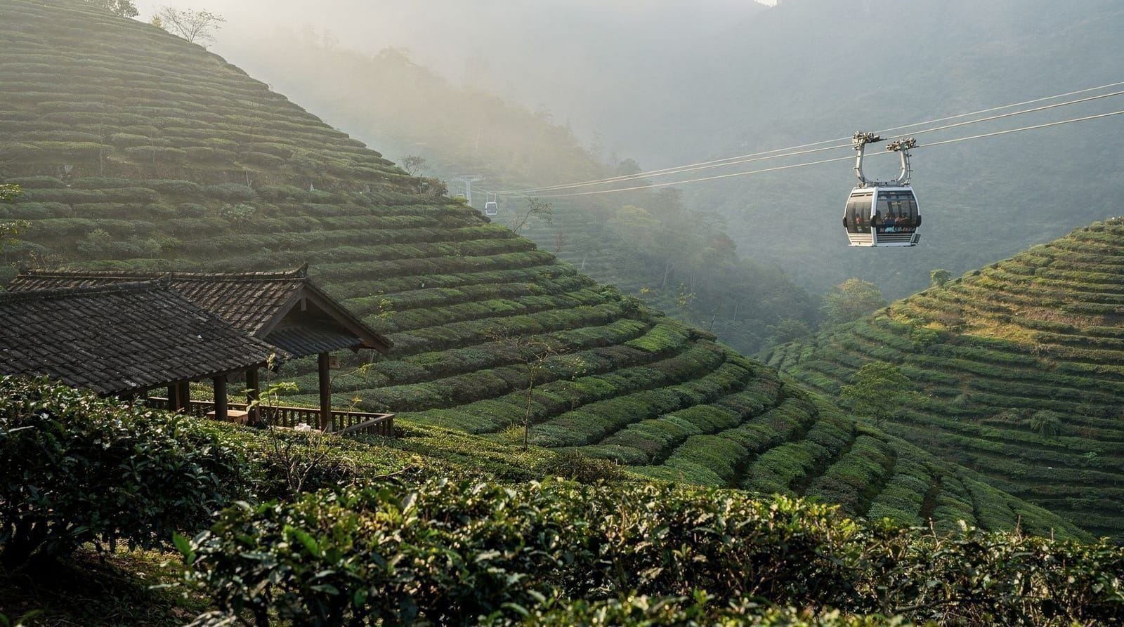
The hills around Maokong are laced with tea plantation paths through oolong and jin xuan plantations. The terrain is gentle compared to Yangmingshan — low rolling hills rather than volcanic ridges. Walking between the plantation areas and teahouses constitutes a pleasant 1–2 hour loop. The gondola handles the elevation gain on arrival and departure.
See Maokong gondola guide for the tea culture context.
How to pair a hike with the rest of your day
The easiest way to get more from a Taipei hike is to decide what comes after it. A short, steep climb like Elephant Mountain pairs naturally with dinner in the Xinyi area, where the skyline you just photographed is right above you; the Xinyi district guide covers where to eat and wander afterwards. Yangmingshan routes end well with a hot spring in Beitou, since the bus back down passes close to it and tired legs are exactly what the water is for. Wulai works the same way, with the forest walk first and the soak second.
Sandiaoling is best treated as part of a Pingxi Line day. Walk the waterfall trail while you still have energy, then ride the branch line on to the lantern towns for a late snack. Maokong is the opposite: the walking is the gentle part, and the teahouse is the real destination, so it suits an afternoon when you want something restful. If you want a deeper look at that side of the hills, the Taipei tea culture guide explains what to order and how to behave once you sit down.
A few planning habits make every route smoother:
- Start early. Mornings are cooler, trails are quieter, and the light on the ridgelines is better for photographs.
- Check the forecast the night before. Mountain weather around the basin can differ sharply from conditions in the city, and views disappear quickly when cloud settles in.
- Keep a flexible plan. If the summit is clouded in, switch to a lower, forested route such as the Neidong trails or a Maokong walk rather than forcing the view.
- Plan your return. Buses on the mountain routes run less often than the MRT, so know your last practical departure before you start walking. The Taipei MRT guide and the EasyCard guide make the city end of each journey simple.
What to wear and carry on Taipei trails
Taipei’s humidity is the main surprise for first-time hikers. Even on a cool day you will sweat on the stone steps, so a light, quick-drying layer works better than cotton. Carry a thin waterproof jacket year-round, because showers can arrive suddenly on the northern mountains, and add a warmer layer if you are heading to an exposed summit. A small towel, sun protection and a bag for wet clothes are all genuinely useful. The Taipei packing tips page has a fuller checklist if you are preparing for a longer stay.
Trail etiquette is simple. Stay on marked paths, take your rubbish back down with you, and greet other walkers, since a quick hello is the norm on the busier routes. Stone steps can be slick after rain, so take them slowly, and let faster walkers pass where the path is narrow.
Seasonal guide for Taipei hiking
| Season | Best hike | Notes |
|---|---|---|
| Oct–Nov | Seven Star Mountain | Best visibility, comfortable temps, ideal summit conditions |
| Feb–Mar | Yangmingshan cherry routes | Cherry blossoms and calla lilies; very crowded weekends |
| Apr–May | Sandiaoling waterfalls | Spring rain increases waterfall flow; moderate humidity |
| Jun–Aug | Elephant Mountain (early AM only) | Heat and haze; go before 09:00 or after 17:30 |
| Dec–Jan | Qingtiangang mist walks | Cool, quiet, atmospheric morning mist; summit cold |
For a guided day combining hiking and cultural sights:
Beitou and Yangmingshan National Park day tourPractical hiking notes for Taipei
Apps: AllTrails covers most Yangmingshan routes in English. Google Maps works reasonably well for trailhead navigation to bus stops.
Water: Bring your own — trail-side water sources are rare and undrinkable. 1.5L minimum for Seven Star Mountain; 500ml adequate for Elephant Mountain.
Phones and signal: Good coverage on Elephant Mountain and Yangmingshan Bus Terminal area; drops in the forested valleys of Yangmingshan and Wulai. Download offline maps before setting out.
Typhoon closures: Check the Yangmingshan National Park Administration website (available in English) during typhoon season. Trails close on short notice during typhoon alerts.
Shoes: Running shoes are adequate for Elephant Mountain and the boardwalk routes. Hiking shoes or trail runners recommended for Seven Star Mountain and Sandiaoling. Rain footwear with grip for wet conditions.
Weather deserves real attention when you plan. The Taipei typhoon season guide explains how storms affect mountain access, and the best time to visit Taipei page helps you choose the months that suit hiking. Anyone building hikes into a longer stay can lay them out against the 3-day Taipei itinerary or, for a slower pace, the 5-day Taipei itinerary.
For more about Taipei’s day-trip options, see best day trips from Taipei. For the transport basics, see Taipei MRT guide.
Which hike fits your time budget
| Time available | Best pick | Why |
|---|---|---|
| Under 1 hour | Elephant Mountain | Closest to the city centre, dramatic skyline payoff for minimal effort |
| Half day (3–4 hours) | Seven Star Mountain or Qingtiangang | Real summit or highland-meadow experience without an overnight |
| Full day | Sandiaoling Waterfall Trail or Neidong (Wulai) | Enough time for a proper forest hike plus a food or hot-spring stop after |
| Combined with sightseeing | Maokong tea hills | Gentle walking paired with teahouses, minimal physical demand |
Frequently asked questions about Taipei best hikes — ranked by effort, views, and access from the MRT
Can you hike in Taipei without a car?
What is the most scenic hike near Taipei?
Are there waterfall hikes near Taipei?
What are the easiest hikes in Taipei for beginners?
Is it safe to hike alone in Taipei?
Top experiences
Bookable activities with verified prices and instant confirmation on GetYourGuide.