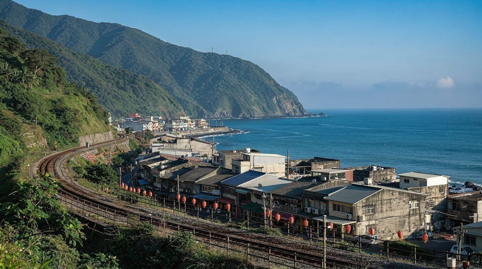
Yangmingshan hiking guide — trails, transport, and what to see
Taipei: Yangmingshan National park hiking day tour
How do I get to Yangmingshan National Park from Taipei for hiking?
Take the MRT to Jiantan Station (Red Line), then Bus S15 or Bus 260 to Yangmingshan Bus Terminal (25–30 min, NT$30–45). From there, buses branch to specific trail heads. No car needed. The park is open year-round; trails close temporarily during typhoon warnings.
Taipei’s volcanic backyard
Yangmingshan National Park sits 15 kilometres north of central Taipei on a dormant shield volcano — the youngest and most geologically active in the Datun Volcanic Group. The park covers 114 square kilometres of volcanic landscape: calderas, hot springs, fumaroles, grasslands, and forested ridges. The highest point, Seven Star Mountain (Qixing Shan), rises to 1,120 metres above sea level.
From the summit on a clear day, you can see the Pacific Ocean to the east, the Taiwan Strait to the west, and Taipei Basin spread below to the south. It is one of the closest national park vistas to an Asian capital city anywhere in the world.
The park is genuinely wild by the standards of urban day trips — macaque troops, Taiwan blue magpies, and Crested serpent eagles are regular sightings — but is reached by city bus from the MRT in under an hour.
| Where | 15km north of central Taipei, on the Datun Volcanic Group |
| Cost | Free park entry |
| Time needed | Half-day for Xiaoyoukeng, full day for Seven Star Mountain |
| Getting there | MRT to Jiantan, then Bus S15 or 260 (25–35 min) |
| Best time | October–November for clear summit views |
Getting to Yangmingshan from Taipei
The standard route:
- Take the MRT Red Line to Jiantan Station
- Exit and walk to the bus stop on the main road (Zhongshan North Road)
- Take Bus S15 (express to Yangmingshan Bus Terminal) or Bus 260 (stops more frequently)
- Journey from Jiantan to Yangmingshan Bus Terminal: 25–35 minutes, NT$30–45 by EasyCard
Alternative boarding points:
- Bus 260 also stops at Shih-lin MRT Station (2 minutes past Jiantan on the Red Line)
- Bus Red 5 (Taipei Bus Red 5) from Xinbeitou MRT serves the Xiaoyoukeng Visitor Center directly — useful if combining with Beitou hot springs
Bus frequency: Every 10–20 minutes on weekdays; more frequent on weekends (but offsets by heavier traffic).
During cherry blossom peak season (Feb–Mar weekends): Private cars are restricted from the upper park area. Park-and-ride buses operate from designated lower car parks. Visitor numbers can be very high — arrive before 09:00 or after 15:00.
The main trails
Seven Star Mountain (Qixing Shan) — the summit hike
Trailhead: Xiaoyoukeng Visitor Center (bus S15 continues past the main terminal to Xiaoyoukeng; or walk 25 min from the terminal) Distance: 4.5km round trip from Xiaoyoukeng Elevation gain: ~600m Time: 2.5–3 hours return Difficulty: Moderate (steep stone steps in sections)
The route from Xiaoyoukeng to the Seven Star summit via the East Peak and Main Peak is the most satisfying hike in the Taipei orbit. The lower section passes through dense cloud forest; the upper section opens to grassland and volcanic rock. The summit has two peaks — the East Peak (easier approach) and the Main Peak (slightly higher, 1,120m, best views).
Views: On clear days (most common in October–November) the entire Taipei Basin is visible to the south. The Keelung River valley extends northeast. Distant ocean on clear winter days.
Summit temperature: typically 5–8°C cooler than Taipei, and significantly windier. Bring a light jacket even in summer.
Yangmingshan National Park hiking day tourXiaoyoukeng fumarole boardwalk
Start: Xiaoyoukeng Visitor Center Distance: 1.2km loop Time: 30–40 minutes Difficulty: Easy (boardwalk)
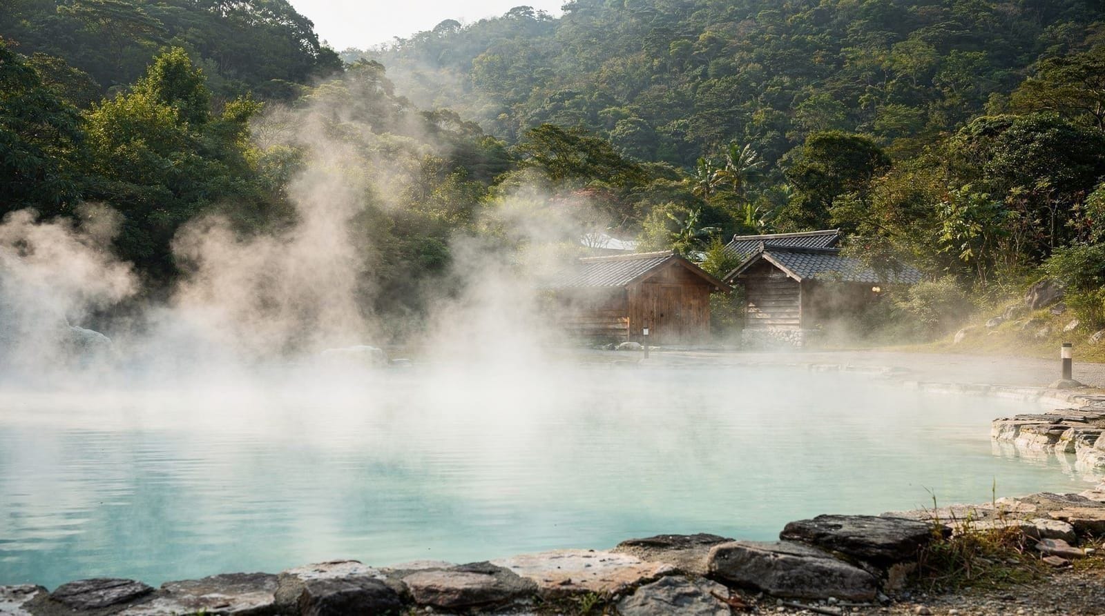
The Xiaoyoukeng crater area features active fumaroles — vents from which volcanic gas (primarily sulfur dioxide and steam) rises continuously. The boardwalk circles the crater rim with English explanation boards covering the geology. The sulfur smell is strong in calm conditions; the visual of white gas rising from the hillside against green vegetation is compelling.
This is the most accessible evidence of Yangmingshan’s active volcanic system and requires no hiking ability. Suitable for all ages.
Qingtiangang grassland loop
Access: Bus Red 5 to Qingtiangang, or 30-min walk from Yangmingshan Bus Terminal via the Maoboqiao trail Distance: 2.5km loop Time: 1–1.5 hours Difficulty: Easy
Qingtiangang is a highland meadow at around 800m elevation, formerly used for cattle grazing. The circular trail follows the meadow perimeter with views across the northern mountain ridge. It is significantly less visited than the Xiaoyoukeng area and rewards early-morning visits with mist filling the valleys below.
Water buffalo still graze the meadow under a care program — expect to see them in the field. Do not approach them.
Lengshuikeng — cold springs and forest
Access: Bus 1717 from Yangmingshan Bus Terminal Distance: Various short loops, 1–3km Difficulty: Easy to moderate
Lengshuikeng sits in a lower valley and has a free public cold spring pool (changing rooms provided, swimwear required). The surrounding forest trails are less famous than the summit routes but very pleasant — mature secondary forest with good birding.
The cold spring pool is a genuinely unusual experience: geothermally heated ground keeps the water at around 22°C year-round, which feels cool to the touch but is warmer than typical mountain water. No soaking hot springs here — for those, head downhill to Beitou (Beitou hot springs guide).
Cherry blossom and seasonal highlights
Taiwan cherry (山桜花, late January–February): The first blossoms of the season, deep pink on bare branches before leaves emerge. Dense groves near Zhongshan Hall and Yangming Park.
Yoshino cherry (吉野桜, late February–March): The more famous pale-pink variety, in rows along the park roads. Creates the classic tunnel-of-blossoms visual.
Calla lily season (February–April): Fields of white arum lilies on the volcanic slopes around Zhuzihu (Bamboo Lake). This is technically outside the national park boundary but accessed by the same buses. Zhuzihu has multiple lily field operators — entry fees around NT$100 per field.
Autumn (October–November): Best overall hiking conditions. Clear skies, comfortable temperatures (12–22°C), low humidity. Least crowded season for the trails.
Summer (June–August): Hot, humid, frequent afternoon thunderstorms that can make summit hiking dangerous. Morning hikes (before 11:00) are feasible. Avoid the summit if clouds are building by late morning.
Season at a glance
| Season | Weather | Crowds | Highlight |
|---|---|---|---|
| Spring (Feb–Apr) | Mild, occasional rain | Very high (blossom weekends) | Cherry blossoms, calla lilies |
| Summer (Jun–Aug) | Hot, humid, storms | Moderate | Morning hikes before storms build |
| Autumn (Oct–Nov) | Clear, cool | Low | Best summit visibility of the year |
| Winter (Dec–Jan) | Cold, foggy at altitude | Very low | Quiet trails, fumarole steam contrast |
Guided options
For a combined Beitou and Yangmingshan day:
Beitou and Yangmingshan National Park combined day tourFor an early-morning sunrise hike on Yangmingshan:
Sunrise excursion at Yangmingshan National ParkIf you want to combine a hike with a hot spring visit in the park area:
Yangmingshan National Park hot spring tourWhat to bring
Year-round:
- Walking shoes with grip (stone steps can be slippery in any season)
- Light waterproof jacket (summit conditions change quickly)
- Water (at least 1.5L for the Seven Star hike)
- Sunscreen (high UV at altitude, especially on the open summit grassland)
- Small snacks (no food available at Xiaoyoukeng; vending machines at the bus terminal)
Spring: Sun hat and allergy medication if sensitive to pollen (high during cherry blossom season) Summer: Extra water, early start, insect repellent Winter: Warm mid-layer, gloves for summit
Practical notes
- Park entry: Free
- Trails: Signposted in Chinese and English at all major junctions
- Maps: Available at the main visitor centers and downloadable from the Yangmingshan National Park Administration website
- Yangmingshan House: A Japanese-era villa in the park that has appeared in various films; can be visited but not entered — the gardens outside are free to walk.
- Monkeys: Formosan macaques are present in the forest areas. Keep food secured and do not feed them. They are curious and will approach if they sense food; backpacks with outside food pockets can be targeted.
Seven Star Mountain detailed trail description
For those planning the Seven Star ascent, here is a section-by-section description of the main route from Xiaoyoukeng:
Section 1 — Xiaoyoukeng to Forest Belt (30 min): The trail begins at the Xiaoyoukeng Visitor Center parking area. The first section follows a well-paved stone step path through the fumarole area before entering the cloud forest. You will smell sulfur here; the fumarole vents are on your left. The forest canopy provides shade. Steps are consistent and wide.
Section 2 — Forest Belt to Grassland (30 min): The trail steepens noticeably and the forest thins as you gain elevation. The steps become more irregular, some cut directly into the bedrock. This is the most aerobically demanding section. At around 900m the treeline breaks and you enter open volcanic grassland — silver grass (Miscanthus sinensis) in autumn, shorter meadow vegetation in spring. Views of Taipei Basin begin to open to the south.
Section 3 — Grassland to East Peak (15 min): A shorter, exposed section across the volcanic ridgeline. Wind increases significantly here — a 4°C Taipei day can feel much colder at this elevation with wind. The East Peak has a marker and a small sheltered area. Many hikers stop here; the views are already excellent.
Section 4 — East Peak to Main Peak (20 min): A short descent and re-ascent along the ridge connects the two peaks. The path is rocky and exposed. In fog (common in winter and early morning), use the trail markers carefully.
Main Peak (1,120m): The summit has a concrete marker, a weather station, and various antennas. Views on clear days extend 40+ kilometres in all directions. The Taipei Basin is the primary feature to the south; Tamsui River to the west; Pacific Ocean to the northeast.
Descent option — Lengshuikeng route: Rather than returning via the ascent, you can descend the alternative trail to Lengshuikeng recreation area (about 60 min descent). From Lengshuikeng, Bus 1717 returns to Yangmingshan Bus Terminal. This creates a satisfying loop rather than an out-and-back.
The Datun Nature Park loop
An alternative to Seven Star Mountain for those wanting a longer but less steep option. The Datun Nature Park loop starts from Datun Nature Park (accessible by Bus 1717 from Yangmingshan Bus Terminal) and traverses forested ridges between Xiaoyoukeng and Datun Mountain (1,092m). Approximately 5km loop, 3–4 hours, moderate difficulty. Less famous and considerably less crowded than Seven Star. Views are similar in quality.
Eating in Yangmingshan
The main visitor services are at Yangmingshan Bus Terminal:
Yangmingshan Bus Terminal area: Several noodle shops, a convenience store, and small cafés operate around the bus terminal. A bowl of Taiwanese beef noodle soup costs NT$100–150. The noodle shops open early (07:30–08:00) for hikers.
On the trail: Nothing. Bring food from Taipei or buy at the bus terminal before ascending.
Post-hike in Beitou: Many visitors combine Yangmingshan with Beitou hot springs and eat in Xinbeitou — see the Beitou hot springs guide for dining options.
Getting around within the park
The park’s internal bus network handles the main sites:
- Bus S15 (express): Jiantan MRT → Yangmingshan Bus Terminal (main stop for most trailheads)
- Bus Red 5: Xinbeitou MRT → Xiaoyoukeng (connects with Beitou hot spring approach)
- Bus 1717: Yangmingshan Bus Terminal → Lengshuikeng → Qingtiangang → Datun Nature Park (for the less-visited interior)
- Bus 130: Xinbeitou → Yangmingshan Bus Terminal (useful for the Beitou combination day)
Buses within the park are included in the standard EasyCard fare system. They run every 10–30 minutes depending on the route; the S15 express runs more frequently.
What the serious hikers do
For experienced trekkers who find Seven Star insufficient, the full Datun-Qixing Mountain Range traverse crosses multiple peaks over 12–15km and is done as a long one-day hike by fit locals. The route exits near Sanzhi or Jinshan on the north coast — requiring onward bus transport back to Taipei or a prearranged pick-up.
The Menghuan Pool (夢幻湖) trail, branching from the Seven Star descent route, leads to a volcanic crater lake of scientific significance — one of very few locations where the endangered aquatic plant Isoëtes taiwanensis grows. The pool is protected and fenced, but the short detour (15 min from the junction) is worth the visit.
For comparison with other Taipei hiking options, see Taipei best hikes guide and Elephant Mountain hike guide. For the Beitou connection, see Yangmingshan National Park. For the full day-trip picture, see best day trips from Taipei and the Taipei in 5 days itinerary.
Fitting Yangmingshan into your wider Taipei plans
Yangmingshan works best when it is slotted into a trip with some thought rather than squeezed in as an afterthought. If you are still deciding how long to stay in the capital, the how many days in Taipei guide helps you see where a full mountain day fits, and the Taipei in 3 days itinerary shows how a shorter visit can still make room for a half-day on the volcano.
The bus ride up is cheap and simple once you have an EasyCard in hand; the EasyCard guide and the Taipei MRT guide explain how to get to Jiantan and tap on to the park buses without fumbling for change. First-time visitors who want the wider picture before heading into the hills will find it in the Taipei first-timer guide.
Timing matters as much as route. If your dates fall in spring, the best time to visit Taipei page and the Taipei cherry blossom guide put the park’s blossom weeks in context with the rest of the city, and the blog write-up on Yangmingshan cherry blossoms is a good companion read for planning an early start. If the weather turns, the Taipei typhoon season guide explains what to expect from the wider forecast, and Taipei in the rain offers ideas for the day you cannot hike.
After a morning on the trails, many people head down to the thermal baths of Beitou; the hot spring etiquette guide is worth a read before your first soak, so you know the rules before you step into the water.
Typhoon season and trail closures
July through September is typhoon season across Taiwan, and Yangmingshan is not exempt. When a typhoon warning is issued, the National Park Administration closes upper trails, including the Seven Star Mountain and Datun routes, until conditions are confirmed safe — sometimes for several days after the storm passes, while crews clear fallen branches and check for landslip. Check the park administration’s website or a Taiwan weather app before setting out during these months; buses to the terminal may also be suspended. Outside active typhoon warnings, summer hiking is still viable if you start early and turn back at the first sign of building afternoon cloud, which is when localized thunderstorms are most likely to form over the peaks.
Is Yangmingshan worth the trip
Frequently asked questions about Yangmingshan hiking guide — trails, transport, and what to see
What is the best hike in Yangmingshan?
What is the best time to hike Yangmingshan?
How difficult is the Seven Star Mountain hike?
Are there hot springs in Yangmingshan?
Do I need to book or pay to enter Yangmingshan?
Can children hike in Yangmingshan?
What are the cherry blossoms like at Yangmingshan?
What wildlife might I see while hiking in Yangmingshan?
Top experiences
Bookable activities with verified prices and instant confirmation on GetYourGuide.